Overview: There are few places on God's good earth more beautiful than the 12,957 acres that make up the Loxahatchee Slough Natural Area in northwestern Palm Beach County. And kudos to the public officials who had the good sense to preserve this land and the taxpayers of the county who made it possible. Loxahatchee Slough is the gem of Palm Beach County's natural area system, representing more than 40 percent of the preserved land under county management.
Loxahatchee Slough, with its network of trails and roads, is the kind of place you can explore for days and still see new things with each step you take. And what you will see will also vary with the seasons.
As you might guess from the name, water is the defining feature of Loxahatchee Slough. It is a very wet place. There are nine distinct habitats within Loxahatchee Slough, including depression marshes, wet prairies, dome swamps, strand swamps and pine flatwoods, all determined in large measure by the presence or absence of water. The slough feeds the federally designated Wild and Scenic Loxahatchee River to the east, and the Everglades, the River of Grass, to the south.

Some of the early explorers considered the land to be impassable, but thanks to the aforementioned trails and roads, Loxahatchee Slough is a fairly easy place to get around. Expect it to be wet and muddy in places during the rainy season, but still accessible along the trails. There are multiple places where the natural area may be accessed, but the easiest point for most is the main entrance on the Beeline Highway. There is ample parking and an informational kiosk with brochures and maps of the trail system.
A quarter-mile ADA compliant concrete trail leads from the parking lot to the first junction point; turn left here and the trail — broad and gravelled — leads along a canal to a borrow pit lake. The only restrooms in Loxahatchee Slough are located nearby. Continue straight at the junction instead and you encounter an observation platform overlooking a broad wet prairie. Continue on your hike and you're on the Loxahatchee Loop Trail. The trail gets primative at this point — the only truly natural surface trail we encountered — but eventually it connects again to a wide and gravelly trail; turn left here. A short distance to the right is the Echoche Trail, which connects to the Ocean to Lake Hiking Trail. Continue straight on the Loop Trail and you pass behind the wet prairie and eventually the borrow pit lake. At the next junction, turn left and you head back along the canal to the concrete trail and the parking lot; turn right and the trail evenutally connects to the Ocean to Lake Trail. Note: the network of old roads are worth exploring, but they can get fairly gnarly at points.

Other highlights: There is a three-story observation tower at the end of the Echoche Trail that provides magnificent views of the surrounding land. Near the tower is a roost for barn swallows built as a Boy Scout project. There is catch-and-release fishing along the canal and at the borrow pit lake, which has a short fishing pier.
There are equestrian-only trails accessible from multiuse trails originating in Riverbend Park in Jupiter and the Karen T. Marcus Sandhill Access Park. Loxahatchee Slough kayak launch and trails is adjacent to the park.
Of Note: Like all natural areas, Loxahatchee Slough is free to enter, open from sunrise to sunset throughout the year. For more details and regulations, check the county website, link above.
Links: The Institute for Regional Conservations's inventory of plants for Loxahatchee Slough is here. Take our virtual tour here. Loxahatchee Slough is not part of the Great Florida Birding Trail, but is an excellent place for bird-watching.
Cover Photo: This photograph conveys exactly how wild and how vast Loxahatchee Slough Natural Area is. At nearly 13,000 acres, it's large enough to support a population of white-tailed deer. Still, encountering him along the Echoche (translated from the Seminole language: Many Deer) Trail was totally unexpected and ranks among the coolest moments we've experienced in putting together Wild South Florida.
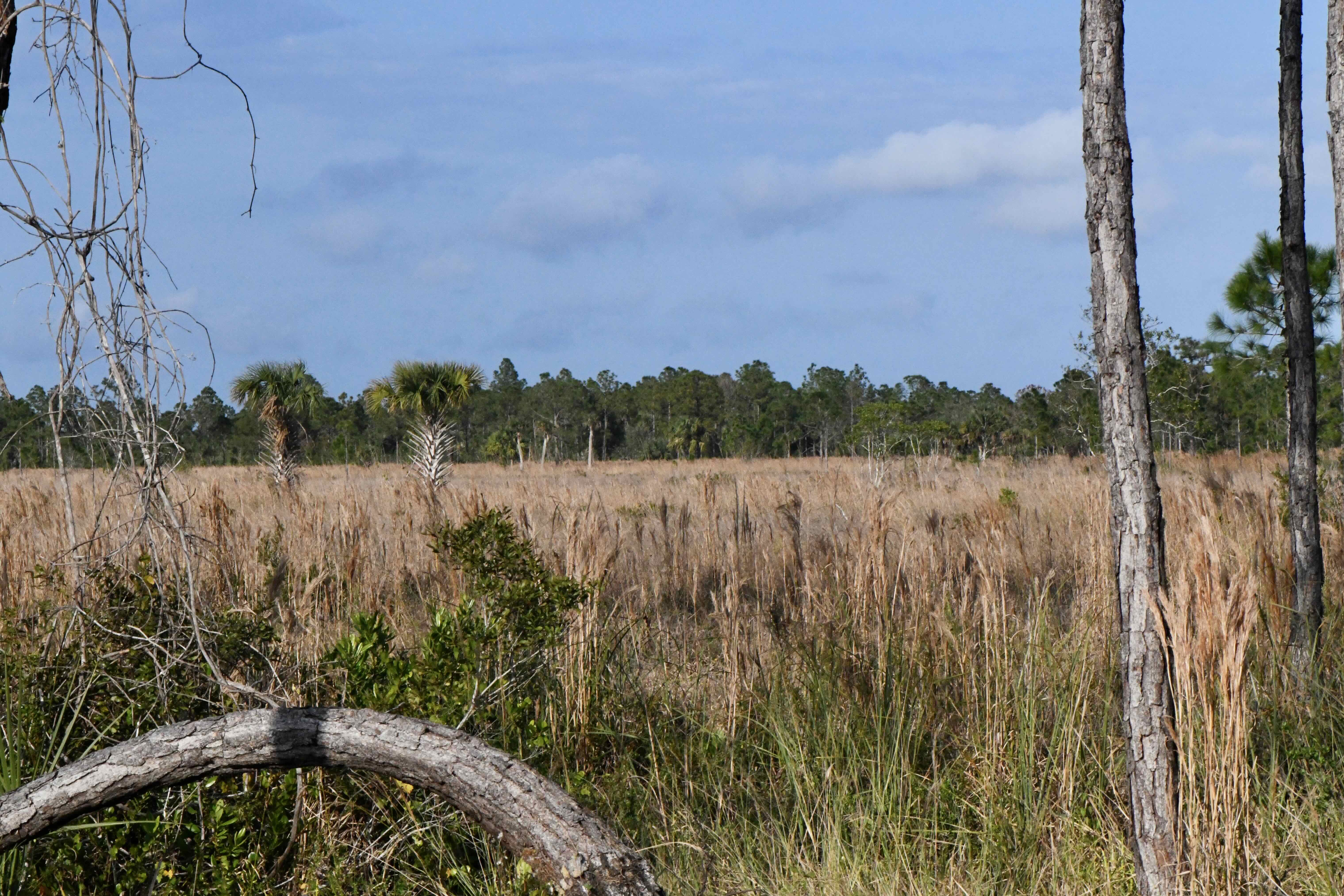
Second Photo: There are places along some of the old roads within Loxachatchee that are so remote one feels like the first person to trod back and view them in years. This is one such place.
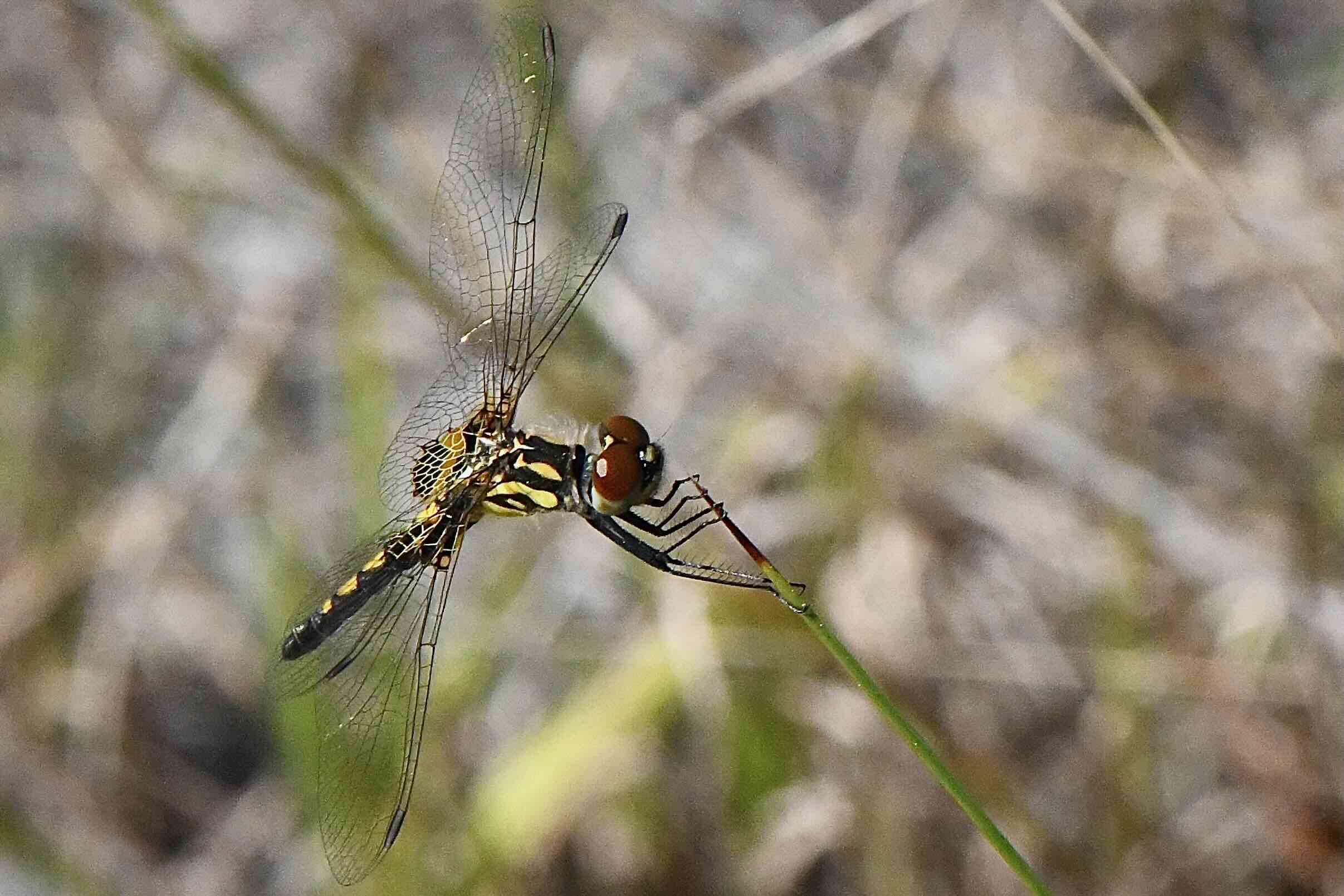
Third Photo: The deer at at the top of this page rates among the biggest of animals we've photographed in South Florida, but there are small things to behold as well, like this ornate pennant dragonfly.
Loxahatchee Slough, with its network of trails and roads, is the kind of place you can explore for days and still see new things with each step you take. And what you will see will also vary with the seasons.
As you might guess from the name, water is the defining feature of Loxahatchee Slough. It is a very wet place. There are nine distinct habitats within Loxahatchee Slough, including depression marshes, wet prairies, dome swamps, strand swamps and pine flatwoods, all determined in large measure by the presence or absence of water. The slough feeds the federally designated Wild and Scenic Loxahatchee River to the east, and the Everglades, the River of Grass, to the south.

Some of the early explorers considered the land to be impassable, but thanks to the aforementioned trails and roads, Loxahatchee Slough is a fairly easy place to get around. Expect it to be wet and muddy in places during the rainy season, but still accessible along the trails. There are multiple places where the natural area may be accessed, but the easiest point for most is the main entrance on the Beeline Highway. There is ample parking and an informational kiosk with brochures and maps of the trail system.
A quarter-mile ADA compliant concrete trail leads from the parking lot to the first junction point; turn left here and the trail — broad and gravelled — leads along a canal to a borrow pit lake. The only restrooms in Loxahatchee Slough are located nearby. Continue straight at the junction instead and you encounter an observation platform overlooking a broad wet prairie. Continue on your hike and you're on the Loxahatchee Loop Trail. The trail gets primative at this point — the only truly natural surface trail we encountered — but eventually it connects again to a wide and gravelly trail; turn left here. A short distance to the right is the Echoche Trail, which connects to the Ocean to Lake Hiking Trail. Continue straight on the Loop Trail and you pass behind the wet prairie and eventually the borrow pit lake. At the next junction, turn left and you head back along the canal to the concrete trail and the parking lot; turn right and the trail evenutally connects to the Ocean to Lake Trail. Note: the network of old roads are worth exploring, but they can get fairly gnarly at points.

Other highlights: There is a three-story observation tower at the end of the Echoche Trail that provides magnificent views of the surrounding land. Near the tower is a roost for barn swallows built as a Boy Scout project. There is catch-and-release fishing along the canal and at the borrow pit lake, which has a short fishing pier.
There are equestrian-only trails accessible from multiuse trails originating in Riverbend Park in Jupiter and the Karen T. Marcus Sandhill Access Park. Loxahatchee Slough kayak launch and trails is adjacent to the park.
Of Note: Like all natural areas, Loxahatchee Slough is free to enter, open from sunrise to sunset throughout the year. For more details and regulations, check the county website, link above.
Links: The Institute for Regional Conservations's inventory of plants for Loxahatchee Slough is here. Take our virtual tour here. Loxahatchee Slough is not part of the Great Florida Birding Trail, but is an excellent place for bird-watching.
Cover Photo: This photograph conveys exactly how wild and how vast Loxahatchee Slough Natural Area is. At nearly 13,000 acres, it's large enough to support a population of white-tailed deer. Still, encountering him along the Echoche (translated from the Seminole language: Many Deer) Trail was totally unexpected and ranks among the coolest moments we've experienced in putting together Wild South Florida.
Second Photo: There are places along some of the old roads within Loxachatchee that are so remote one feels like the first person to trod back and view them in years. This is one such place.
Third Photo: The deer at at the top of this page rates among the biggest of animals we've photographed in South Florida, but there are small things to behold as well, like this ornate pennant dragonfly.


